How Drones Can Benefit Construction Sites

Brian King
Geographic Information System Specialist
Using drones for mapping, surveying and inspections saves time and money, gives easier access to dangerous areas, collects data quickly, offers high-resolution orthoimagery and high positional accuracy, and boasts survey-grade precision with less time, people and equipment.
Traditional survey methods only measure individual points, are a significant time and cost investment, and can only be done in accessible areas. Aerial photography using a plane or helicopter can get costly with pilot and fuel costs, and the footage must be from higher elevations.
GIS Analyst Brian King and Construction Manager Rami Abusheikh examined the range of uses for drone data in a presentation for CMAA Focus2.0, the online version of the Construction Management Association of America’s Focus20 Conference, created after the in-person event was canceled because of the coronavirus pandemic.
Each mission can produce footage and data that can be applied for a variety of insights:
Proposals and bidding
Make proposals stand out, give accurate estimates, verify and calculate bid quantities, create virtual designs and models, and improve planning.
Existing conditions
Create high-resolution 3-D models, help with site planning and layout, assess existing damage, superimpose drawings over images and model.
Measurements and calculations
Gauge stockpile measurement and tracking, and check cut and fill quantities, field measurements and elevation profiles.
Progress and inspection photos
Capture the entire project, track progress in a side-by-side comparison, save time, increase efficiency, reduce risk/liability and create live-streaming video.
Final completion photos
Eliminate using a plane and cut out the pilot and fuel costs, fly at lower elevations for a higher quality image and have increased client satisfaction.
FAA Operational Limitations
While drones provide substantial benefits, they’re governed by Federal Aviation Administration regulations. Limitations include a maximum groundspeed of 100 mph, maximum altitude of 400 feet Above Ground Level or within 400 feet of a structure, and minimum weather visibility of 3 miles. Pilots can’t operate from a moving vehicle unless operation is over a sparsely populated area, can’t operate directly over people or directly moving vehicles and must yield right of way to other aircraft.
To operate a drone for commercial use, pilots must obtain an FAA Part 107 certificate by passing an Initial Aeronautical Knowledge Test. Pilots must be 16 years old; be able to read, speak, write and understand English; and be in a physical and mental condition to safely fly a drone. The certificate is then valid for two years.
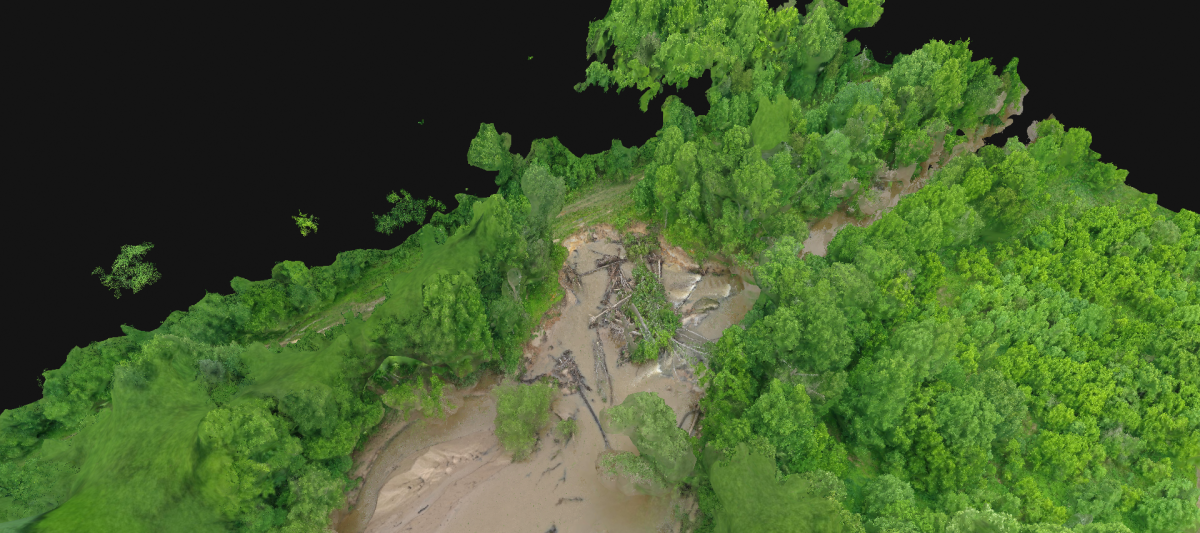
This drone footage shows a stream’s shift that threatened a community’s utilities in North Carolina. Thanks for drone footage versus traditional methods, teams were able to quickly assess the streambank.
Brian King, GISP, RPA, CFM, is a Geographic Information System Specialist and approved drone pilot in Austin.