When Every Minute Counts: Real-Time Forecasting During the Storm

Nina Reins
Water Resources Engineer
First in a series; see more under Related Articles below.
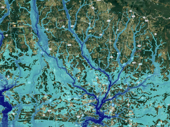
During a hurricane or tropical storm, one of the biggest threats to communities is compound flooding from storm surge and precipitation. Forecasting storm surge and riverine flooding in real time, however, is incredibly challenging — especially in Louisiana, which has a complex coastline and an extensive network of bayous, canals, flood gates, pump stations, and levees.
Our multidiscipline team is addressing this challenge by providing Louisiana’s decision-makers with flood guidance in real time. With a 15-year track record of proven success, our team deploys supercomputer-powered models to rapidly inform critical decisions at a large scale.
At the heart of this work is the decision support tool developed and coded by senior hydrologist Katelyn Costanza, PE, CFM, the owner of CE Hydro, LLC, a Louisiana-founded woman-owned small business. Robert Twilley, at Louisiana Sea Grant, has been a key collaborator and supporter of this effort. Highly specialized hydraulic modeling resources from Freese and Nichols, led by Jim Keith, PE, CFM, and Bethany Fleitman, PE, CFM, have provided riverine modeling support to update, calibrate and validate a 2D model of the Lake Pontchartrain and Lake Maurepas watersheds. In addition, team member Jason Fleming, Principal of Seahorse Coastal Consulting, is the lead of the real-time ADCIRC Surge Guidance System (ASGS) for Louisiana and integrates critical surge data, while Carola Kaiser at the LSU Center for Computation and Technology led the development of visualization tools for the real-time forecasts on the Coastal Emergency Risks Assessment (CERA) website. The work is being done for the Louisiana Coastal Protection and Restoration Authority (CPRA) and Louisiana Sea Grant.
Real-Time Visualization
Whether it’s before, during or after a storm event, emergency management personnel can easily access forecasts using the Coastal Emergency Risks Assessment (CERA) system. The website features a user-friendly Google Maps interface and GIS-compatible data export capability. With real-time visualization, CERA displays key critical factors, such as water elevations in coastal waterways, overland flood depth, wave heights, and onset time of tropical-storm-force winds.
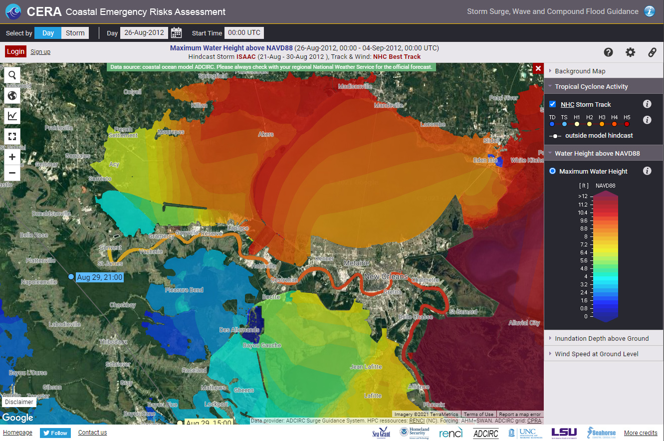
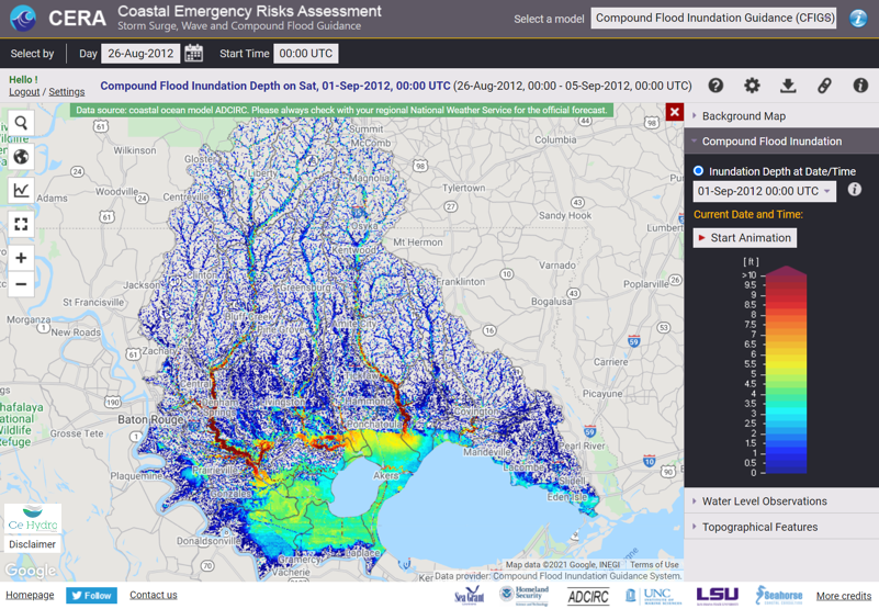
CERA’s guidance is based on the ADCIRC Surge Guidance System (ASGS) and Compound Flood Inundation Guidance System (CFIGS) models, which in turn are based on official data sources including the National Hurricane Center. CERA has been developed at LSU with support of Louisiana Sea Grant since 2006.
CERA’s broad acceptance is evidenced by the increasing number of organizations that have consulted it, including state and federal agencies; the National Guard, Navy and Coast Guard; oil and gas companies; and numerous municipalities and levee districts. The National Oceanic and Atmospheric Administration (NOAA) encouraged its audience to use CERA forecasts ahead of Hurricane Delta in 2020.
Read more from the LSU Office of Research & Economic Development: Partnerships Improve Hurricane Storm Surge Forecasts for Louisiana, Nation
Nina Reins, PhD, PE, PMP, is a senior coastal project manager in New Orleans.