Freese and Nichols Kicks Off Next-Generation Flood Mapping Project in Houston Area

Krista Melnar
Stormwater Practice Leader
 Freese and Nichols has begun a Harris County Flood Control District project whose findings could shape the urban flooding conversation locally and nationally.
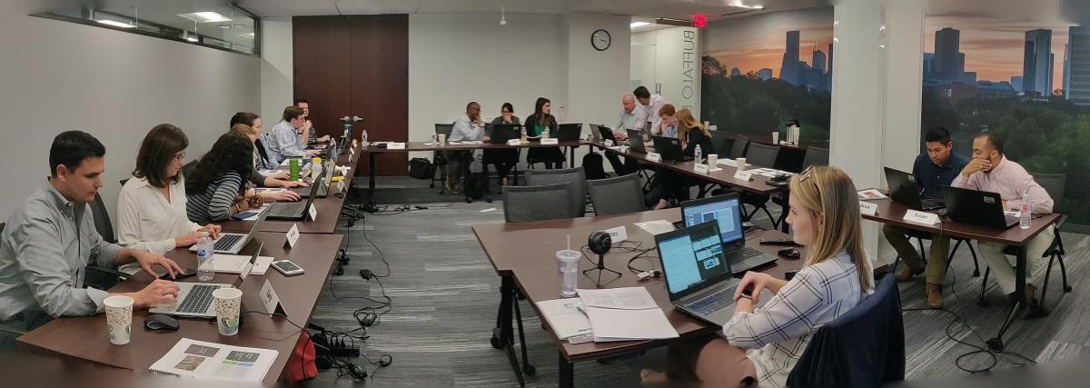
Last month, stormwater engineers from across the company mobilized for the first phase of the District’s Modeling, Assessment and Awareness Project, or MAAPnext. The team conducted weeklong training in Houston to keep up to date with the latest modeling technology and methodologies.
One of seven firms working on separate watersheds, Freese and Nichols will perform flood risk analysis and mapping that will produce new and updated flood hazard data for the Cypress Creek and Addicks Reservoir Watersheds. The team will build detailed HEC-HMS models for a combined 410 square miles and 1D/2D unsteady HEC-RAS models for approximately 226 miles of studied streams.
Working with HCFCD and the Federal Emergency Management Agency, the project will use the latest available technology and data to produce the county’s most comprehensive and complete set of flood hazard maps. The modeling results will help the public understand flood risk and local governments regulate it. Phase 1 of MAAPNext is scheduled to be completed in 2021, for delivery to FEMA.
HCFCD serves the 4.6 million people of Harris County, Texas, including the City of Houston, through flood damage reduction plans and drainage infrastructure. Among Freese and Nichols’ notable recent projects for HCFCD are the Upper Langham Creek Frontier Program, serving as program manager since 2012; and disaster recovery services related to Hurricane Harvey.
Krista Melnar, PE, CFM, PMP, leads the Stormwater Practice and is based in Austin.