What To Do With Playas: ICPR4 Offers 2D Advantage

Heather Keister
Areas of flat terrain that include playa systems offer a unique challenge for hydrologic and hydraulic modeling. One possible solution is using Interconnected Pond Routing (ICPR) Version 4 software, which encompasses a 2D capability that can model flow across flat areas.
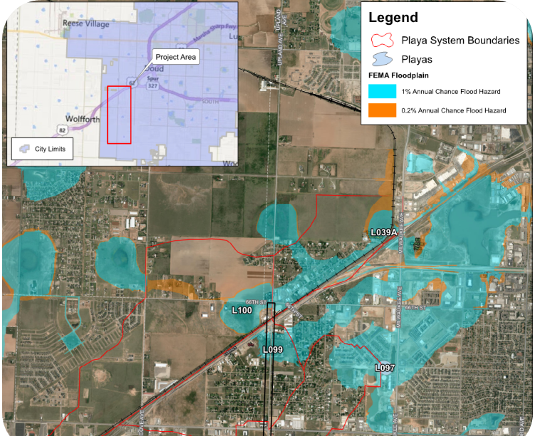
As the drainage lead on a roadway design team for the City of Lubbock, Freese and Nichols used ICPR4 software for modeling the existing and proposed conditions of Upland Avenue. Located on the west side of Lubbock, the corridor is a two-lane, strip paved county road with roadside ditches in the right-of-way. The proposed section is to be reconstructed and widened to a five-lane, curb and gutter arterial with a shared use path.
Because the proposed roadway is located near and within several playa lakes, the 2D H&H modeling capability of ICPR4 was utilized to analyze the existing and proposed drainage infrastructure. Previously, ICPR version 3, a version of the software that only has 1D capabilities, was primarily used for the City of Lubbock modeling. However, ICPR4 allows both 1D and 2D elements to interact with one another. The ICPR4 software has the capability to consider surface ponding and impacts from nearby playas.
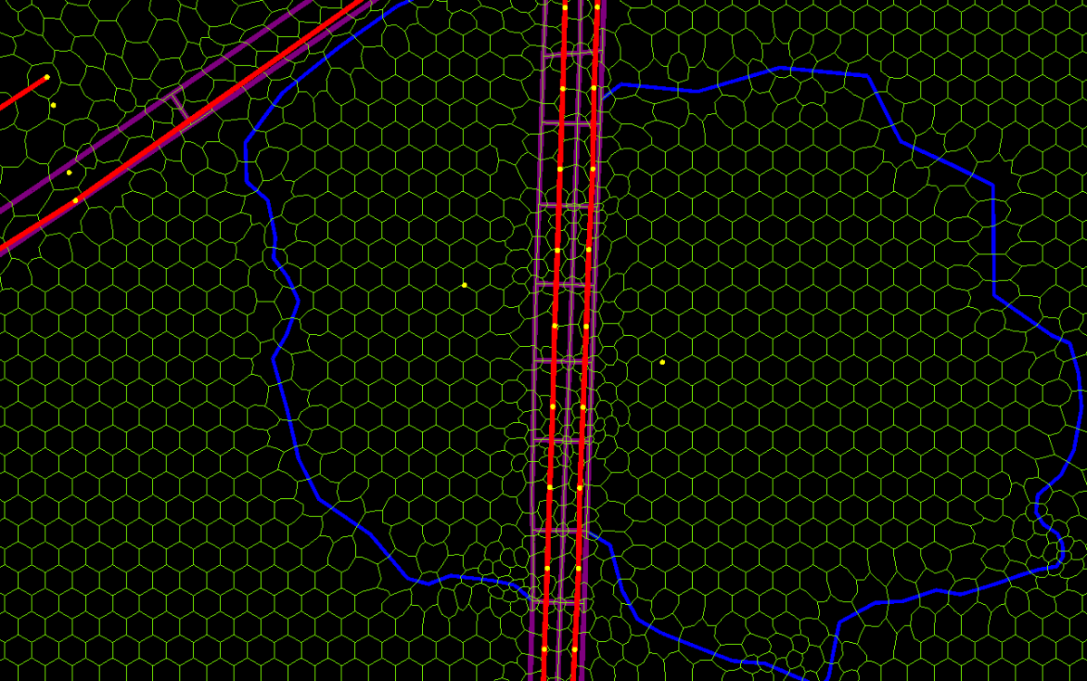 Discrete objects, such as pipes, channels and nodes, are defined with 1D objects while surface flow is defined using a 2D mesh. When the capacity of the 1D network is exceeded, the excess runoff transfers to and accumulates on the 2D surface through defined channel or pond control volumes, resulting in inundation on the 2D mesh.
Benefits of 2D
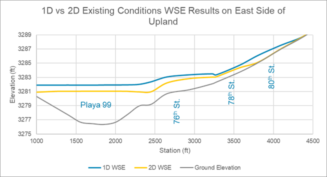
By utilizing the software’s 2D capability, flow depths within the right-of-way and along overflow paths were more accurately defined. The 2D ability of the software allows flow to spill throughout the mesh, which lets water travel to lower elevations and minimize situations of artificially high flow depths which happens when flow is trapped in 1D components with no release to 2D.
By utilizing the 2D model components, the model results revealed a reduced need in infrastructure size, which saved the client money. The peak flow depths in the roadway section and parallel channel were up to 1.4-feet lower in the 2D model as compared to the 1D model. This difference translates into less channel excavation, milder sideslopes, and the option to lessen expensive channel lining. The 2D model also captured widespread and overland flow, more accurately reflecting the location and direction of playa overflow. This is beneficial to better define areas of inundation for Lubbock’s flat topography.
For projects such as the improvements along Upland Avenue, ICPR4 was beneficial in establishing the roadway profile above peak playa elevations. The modeling results also ensured that there were no adverse impacts to adjacent properties.
When to Use 2D?
The model capabilities of ICPR4 are proving to be a solution for flat topographic areas such as Lubbock. Using ICPR4 and its 2D capabilities helped inform the impacts of the playas, accurately analyzing overflow discharges, and providing additional detail for flow spilling to and from the right-of-way. Model results between 1D and 2D analyses tended to diverge closer to playa lakes, where hydraulic elements were taxed more heavily. Model runtimes can still be minimized by utilizing the 1D components in conjunction with 2D components.
Heather Keister is a Senior Project Manager, who provides West Texas cities with innovative, practical and cost effective stormwater solutions based on her experience planning, analyzing and designing stormwater infrastructure.