TWDB Announces 15 Flood Planning Regions

Scott Hubley
Stormwater Engineer
 The Texas Water Development Board (TWDB) has announced its designated 15 flood planning regions to help establish a new regional and state flood planning process.
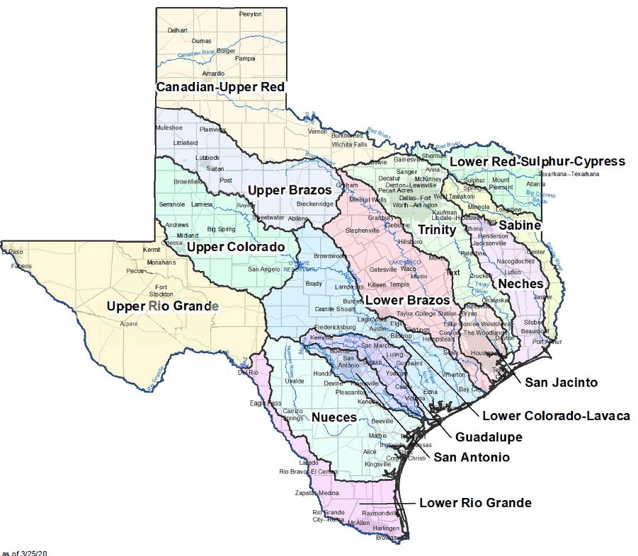
The TWDB divided the state into regions based on river basin watersheds, and the process will develop technical tools that local decisionmakers can use to determine the best solutions for their areas. The regional flood-planning groups will develop and submit their flood plans to the TWDB for incorporation into the State Flood Plan.
Click here to see a map of the flood region boundaries
In designating the region boundaries, the TWDB adhered to Senate Bill 8, passed during the 86th session of the Texas Legislature, taking into consideration stakeholder input from the board’s summer 2019 “listening tour” and stakeholder comments received between Jan. 17 and Feb. 3 on a proposed set of boundaries.
The designated regions are as follows:
- Canadian-Upper Red
- Lower Red-Sulphur-Cypress
- Trinity
- Sabine
- Neches
- San Jacinto
- Upper Brazos
- Lower Brazos
- Upper Colorado
- Lower Colorado-Lavaca
- Guadalupe
- San Antonio
- Nueces
- Upper Rio Grande
- Lower Rio Grande
Earlier this week, the TWDB pushed back its Flood Infrastructure Fund Abridged Applications deadline Monday, June 15 at 5 p.m. Read more here.
Scott Hubley, P.E., CFM, is a Stormwater Project Manager in Fort Worth.