Unpredictability of Mother Nature: The Impacts of Rainfall from Dorian and Imelda

Krista Melnar
Stormwater Engineer
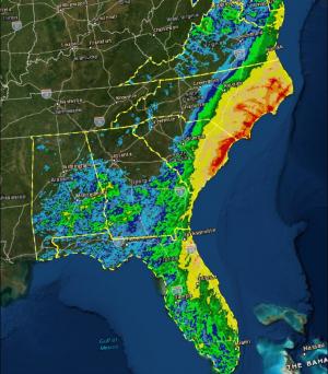
In late August, Dorian began as a tropical wave. By September 1st, it had rapidly intensified into a Category 5 hurricane and proceeded to sit stationary over the Bahamas wreaking havoc. After about a day or so, Dorian weakened considerably and proceeded northwest to parallel the east coast, starting in Florida. It did not make landfall until reaching North Carolina as a Category 1 on September 6th. The storm’s slower-moving nature allowed several states on the east coast to take extensive precautions by declaring states of emergency and enforcing mandatory evacuations. Luckily, much of the storm’s impacts to the U.S. were relatively minor.
In a very different unfolding of events, Imelda intensified in southeast Texas this week. Within several hours, Imelda was upgraded to a Tropical Storm that over the following few days became the fifth-wettest tropical cyclone on record in the continental United States; the rate at which it intensified limited the timeframe with which to respond and take precautions. Several areas experienced rainfall intensities greater than those experienced during Hurricane Harvey, which hit the Texas coast a mere 2 years ago.
Meanwhile, Hurricane Jerry is gaining strength near St. Maarten and Barbuda.
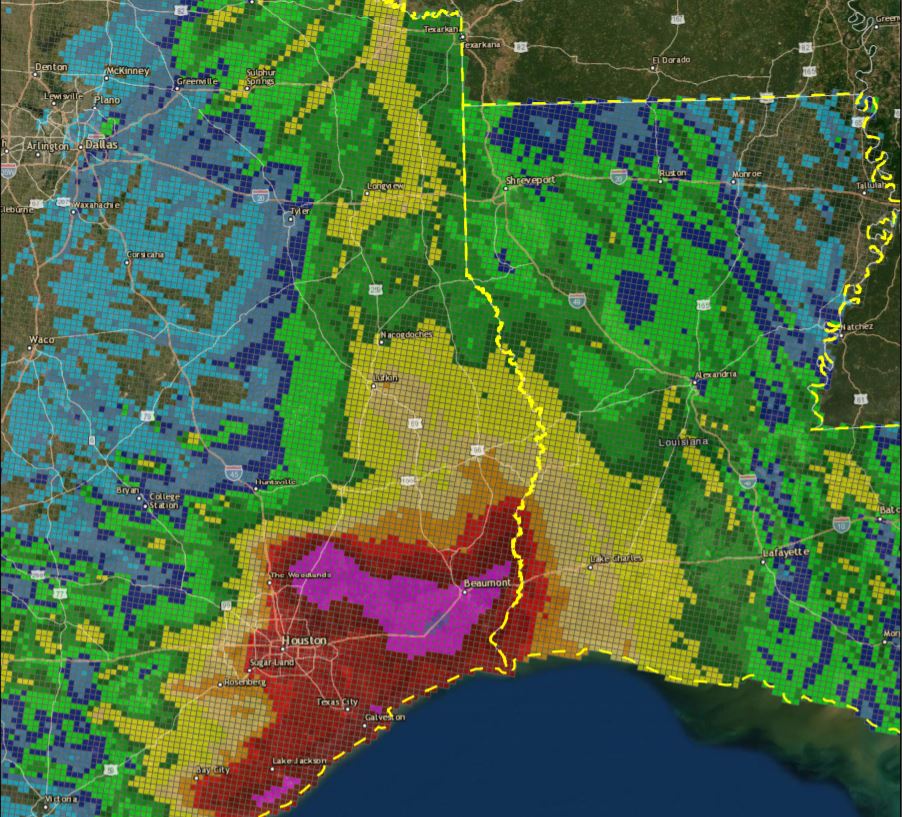
As we described in a previous article, FNI has developed a new tool that analyzes gauge-adjusted radar rainfall data over a specific area and timeframe. We used our tool to evaluate both Dorian and Imelda for storm intensities and volumes. As shown in the following results, the tool not only summarizes total rainfall, but it also produces tables and figures to describe the storm’s effect on a location. The intensity graphs depict average rainfall intensity of the storm associated with specific durations, and plots this in a way to compare to standard frequency events. Winnie, TX not only experienced some of the largest rainfall totals during Imelda but also experienced unrelenting high intensities.
If you’d like us to perform an evaluation of a historic storm event in your area, please contact Garrett Johnston at garrett.johnston@freese.com.
Krista Melnar, PE, CFM, PMP, is the Stormwater Practice Leader in Austin.